Living with a daughter and two granddaughters takes a lot of
energy. We planned to take Meredith, Molly and Nuala on a suitably exhausting
walk around Dunwich.
Almost all walks from Dunwich start at the beach car park.
The path passes right by the edge of the cliff, which is sandstone and not
particularly stable. Keeping Molly (nearly 8) and Nuala (4) from going on the
rampage along paths which are single file causes anxious moments and sharp
words among the adults. However, the beach view is panoramic and glorious.
The route winds its way through woodland which, in the
distant past, was managed by a complex of a priory and other religious
buildings. I’ve not worked out whether or not the orders were associated with
each other administratively. Nevertheless, they are physically in very close
proximity. The woodland is fairly open, the footpaths well-marked and perfect
for walking. The shady environment meant that we didn’t notice the sun getting
hotter.
After about 1½ miles, we get to the heath proper that ranges
between Dunwich and Mimsmere Nature Reserve. At this time of year the heather and gorse are
in bloom.
 |
| Gorse and heather in bloom |
The sun is hot and so are the adults, but Molly still insists
on wearing a cardigan.

Nuala collects pine cones. (Where did they come from? I’m
clearly not very observant.)

Fortunately, there is a rural bench conveniently placed at
almost the mid-point of our route. Nuala uses a very dainty receptacle to
quench her thirst.
 |
| Nuala quenches her thirst from an elfin cup |
Meredith still has Allen blood in her genes, notwithstanding
the change of name. She insists on avoiding retracing her steps as far as
possible. It provides the opportunity for Molly to revisit a play puddle (perfect
for her 3 year-old self) while her parents hid in the bushes. Apparently, Molly
was completely un-phased and just demanded supper volubly when she had finished
playing.
The day was now hot. There was not much shade and the route
back to the car park was very tiring for small legs. Molly managed the whole
way and even Nuala was only carried for a couple of hundred yards. Fortunately,
Dunwich car park is home to a Flora
Tea Rooms. There we treated ourselves to chips and Earl Grey Tea.
Mapping
Google maps is one of the more wonderful developments to
come out of the age of the internet, but it also presents some challenges, For
someone brought up on the UK’s Ordnance Survey maps, it comes as a surprise that
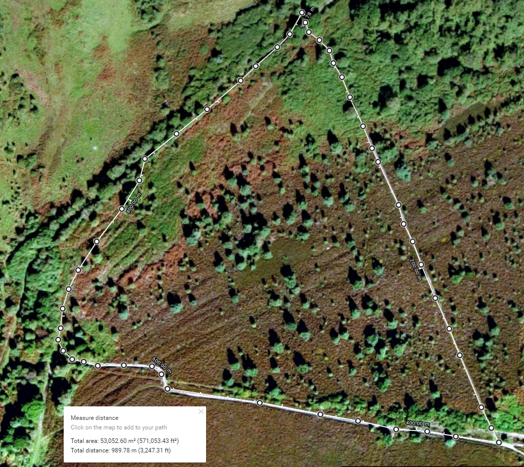
footpaths are not included. But you can mix and match with Google earth. This
is how I first mapped our route, which show a mileage of just over 4. Certainly
enough to tire out little legs.
 |
| Route using Google Earth |
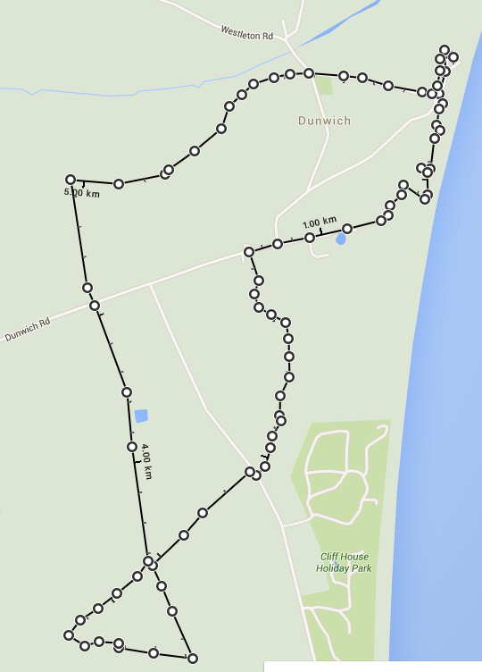
Converting back to Google Maps, we get a very clear route
map, but no features whatever. This is frustrating from someone brought up on
the OS presentation.
The features on the heathland section were very difficult to
follow. I have tried to map it in more detail. It was an interesting
experiment, but I’m not sure that improves the accuracy greatly.
For Molly and Nuala, the ice cream at the end of the walk
was clearly far more important.

No comments:
Post a Comment